

Cape Falcon Trail
Just a few miles from Cannon Beach. Hike is 2.4 miles each way. Allow 3 to 3.5 hours. Highest point 300 feet. A gradual hike with ocean vistas. Can be muddy in the spring and fall if it has been wet. Travel to the Cape Falcon Trail by taking Hwy 101 South to Oswald West State Park. Park at the first parking lot on the west side of the highway.
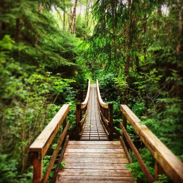
Arch Cape Creek Trail
Close to Cannon Beach, the trail begins at Arch Cape off Shingle Mill Lane, a swinging bridge crosses Arch Cape Creek. At this point, you enter Oswald West State Park. 5-mile stretch to Cape Falcon. Lush Oregon Coast rainforest & rushing creeks.
Neah-kah-nie Mountain Trail
Just a short drive from Cannon Beach. Hike is 2.7 miles each way. Allow 3 to 4 hours. Challenging & highly recommended hike. High point on the trail rises to an elevation of 1,631 feet. Usually open all year. Travel to Neah-kah-nie Mountain trail by way of Hwy 101 South to point 2.6 miles south of the Short Sands parking area. Spectacular ocean & mountain views.

Cape Lookout Trail
2.6 miles each way. Allow 3 to 4 hours. High point is 830 feet. Open all year. Travel to Cascade Head trail by taking Hwy 101 South to the Three Rock Road just North of Salmon River in Tillamook County. Stop at the Tillamook Visitor’s Center for more information and directions.

Short Sands Beach
From the North, this one-mile hike down to beach begins about five miles south of Arch Cape in Oswald West State Park. There are three parking lots: Best to take the one on the east side of Hwy 101. Rainforest and along a creek emptying in the ocean. Beautiful hike on the Oregon Coast.

Ecola Park to Indian Beach Trail
At the north end of Cannon Beach. Dramatic views of the Oregon Coast. A moderate 1.5 mile hike each way. Allow 90 minutes to 2 hours. Trail leaves from the parking lot of Ecola State Park. Provides open views of the ocean, off-shore rocks, myriads of birds and occasional sea lions.

Tillamook Head Trail
Up and back to Tillamook Head area. 2.5 to 4 miles each way. Allow 3-4 hours. Longer 9+ miles each way for end-to-end hikes, beginning at either Seaside or Indian beach. Most groups leave cars at each end. Highest point along the trail is 1,200 feet. Can be muddy during wet weather. The Tillamook Head Trail traverses a cape jutting out into the sea between Seaside & Cannon Beach near Ecola State Park. A shorter day-trip starts at Indian Beach.

Saddle Mountain Trail
2.5 miles each way. Allow 3.5 hours. Highest peak in the Northern Coast Range. Hiking boots recommended. Wild flowers abound. Usually open March to December. Take Hwy 26 East from Hwy 101 to Milepost 10. Trailhead is 7 miles in from Hwy 26.

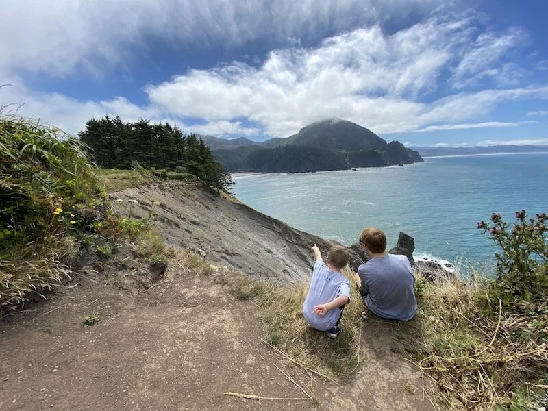
Devil’s Cauldron
Located inside Oswald West State Park, Devil’s Cauldron is a mile south of the Short Sands Beach parking area. Look for a parking pullout on the west side of Hwy 101. Trail heads west toward the ocean.

Nearby Logging Roads
There are a number of logging roads on the east side of Hwy 101. Though these are private lands, logging companies typically allow people to hike the property during daylight hours. No camping or hunting.
